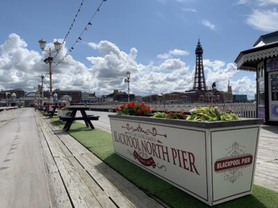
The Fylde coast experiences a large tidal range and generally an onshore wind. Together these two completely natural and unstoppable factors can lead to extreme conditions. Maintaining Blackpool’s Coastline is a constant, ongoing battle against the forces of nature. Three schemes are under development to protect 12,000 properties from the risk of flooding.
Maintaining Blackpool’s Coastline
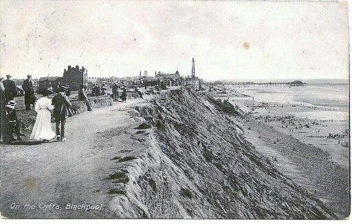
Anyone interested in local history will have seen the old photos online of the cliffs and seawall, crumbling into the sea. It’s where Red Bank Road gets its name from – the red tinted, boulder clay cliffs.
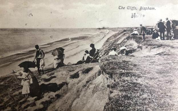
Often in response to flooding, sea walls have been built, added to, improved and redesigned many times over the decades. For example, between 1919-1921, Red Bank Road to Arundel Avenue was protected by a re-enforced and stepped concrete apron.
Arundel Avenue to the northern boundary at Kingsway (adjoining Wyre/Cleveleys) was last to be completed. Started in 1932 and opened by the Duke of Kent in 1937. The northern part with a 30-foot carriageway, protected by a 3-foot-thick concrete wall. The southern part of this section is in two stepped levels and only for pedestrians, complete with concrete beach chalets.
Past Floods in Blackpool
Several significant flooding events have taken place along this coastline. The floods of November 1977 are a vivid memory for many, with serious inundation for hundreds of properties up to a kilometre inland.
Pic of flooding
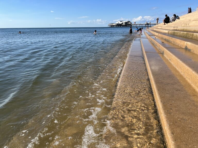
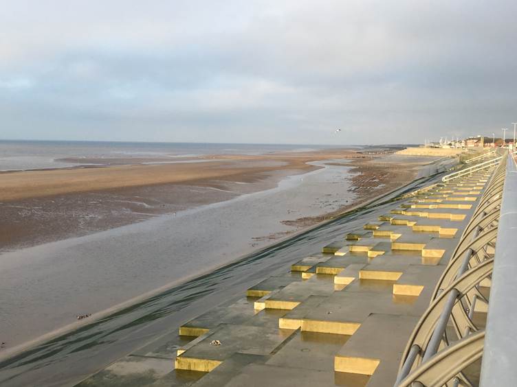
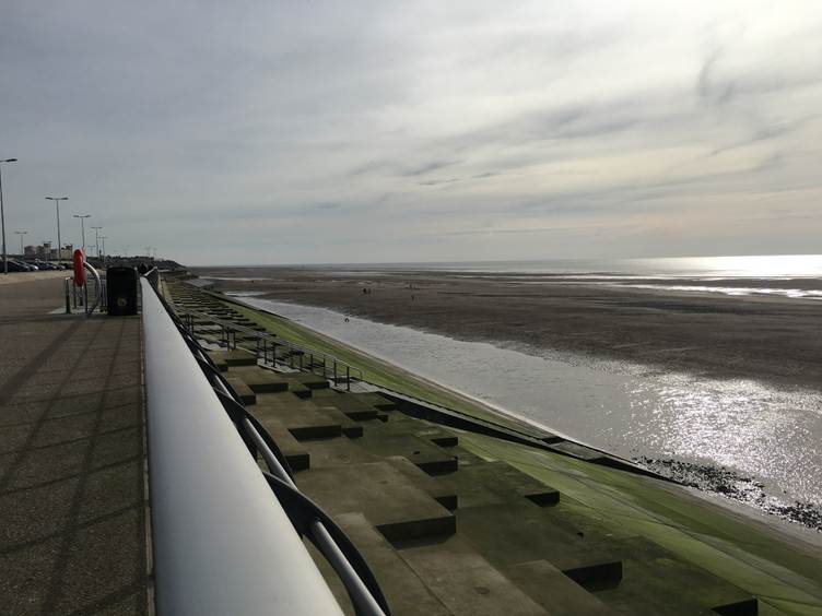
Accessibility of this stretch of beach has been a big problem for many years. You may have seen the large sandbars, separated by deep channels full of fast-flowing water. In fact the beach can often be inaccessible due to huge ponds forming along the base of the sea-wall. This ponding is a result of big waves scouring the beach as they break and ebb against it.
FREE Newsletter
FREE Newsletter

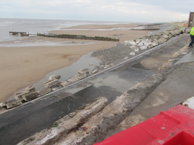
The huge rocks used in this scheme will help to reduce the energy of the waves as they reach the sea wall. Reducing their impact reduces their ability to scour – this helps to stabilises the upper beach and keep it in place during stormy seas. In turn that means a more useable amenity and recreation space, a better local landscape and biodiversity improvements too.
Maintaining Blackpool’s Coastline
Coastal management and engineering is a very complex science. Apart from the known physics and engineering it also includes unknown variables like the weather and rising sea levels.
In the past 30 years Blackpool Council has successfully delivered over £150 Million of coastal infrastructure. These include schemes at New South Promenade and the Anchorsholme Coast Protection Scheme. Future schemes will further protect homes and businesses as well as vital infrastructure. Many coastal communities are experiencing the devastating effects of coastal erosion. It is critical that we act now to protect our coast.
All coastal areas have a Shoreline Management Plan (SMP). These are large-scale strategic documents which assess the risks of coastal flooding and erosion, outlining a 100-year plan for managing the coastline. They balance risks to people, property, and the environment by defining how specific stretches of the coast will be adapted.
Hold the Line
From Squires Gate to Anchorsholme Park, the strategy to 2105 is to ‘Hold the Line’. Maintaining or upgrading the existing coastal defences to keep the shoreline in its current position. In reality it means that the land, buildings and infrastructure up to the coast line will be protected.
Where protection is currently provided by coastal defence structures or managed beaches, and the intention is to retain a defence along approximately the current alignment. This will involve replacing defences when needed. Defence type, method and standard of protection may be modified over time.
Reducing the Risk of Erosion and Flooding
Most of us have seen examples of sea walls that have been damaged or collapsed – not just here in Blackpool but in other coastal towns too. Sea walls only last between 30 and 60 years, depending heavily on the material used and the harshness of the local marine environment.
It would be impossible to prevent flooding and erosion from the sea. The cost would be astronomical, and need unacceptably huge/intrusive hard engineering. A balance is reached between the benefits of a scheme versus how much it impacts the beach environment and what it costs.
Current and forthcoming coastline works are designed to reduce the risk of sea walls being damaged. Or in the worst case, being undermined and collapsing. Beaches and walls are also designed to reduce the risk of overtopping and flooding.
Current Projects Maintaining Blackpool’s Coastline
Anchorsholme Coastal Protection Scheme
Kingsway (Cleveleys) to Little Bispham tram stop
On behalf of Blackpool Council, Balfour Beatty is carrying out construction works and building new groynes between the boundary with Cleveleys and the slipway at Little Bispham. These works will reduce the risk of coastal erosion and flooding by helping to stabilise the revetment, reduce overtopping from the sea and stabilise and retain the upper beach.
Blackpool Bispham Coast Protection Scheme
From Cocker Square (just north of North Pier) to Gynn Square. And from Bispham to Little Bispham.
This will help protect the coastline from erosion and prevent homes being lost to the sea. The proposed scheme will see sixteen rock groynes built along the beach, in two areas.
Blackpool Beach Management Scheme
Cocker Square to South Pier
While you’re here…
Go to the homepage of the Live Blackpool website for the latest updates.
Love the Fylde Coast? Sign up for your email newsletter. Packed full of interesting things it arrives in your inbox all 52 weeks of the year.
Join us on Facebook at our Visit Fylde Coast Facebook Group and follow us on Twitter @visitFyldeCoast
Plus hundreds of videos to watch on our YouTube channel – from all over the Fylde Coast!
Booking a stay? Pick a safe, clean and legal place to stay, at the very best price. Book with the Visit Fylde Coast and StayBlackpool guide.

We Need Your Help
We Need Your Help